McDougall · Parry Sound District
Harris Lake
A shallow, warm lake in the Municipality of McDougall, north of Parry Sound in the Seguin River watershed, with a fully private shoreline and no Crown land.
My take
Why I know Harris Lake
Harris Lake is in McDougall, near Waubamik, a short way north of Parry Sound. It covers 157 hectares and is shallow: 8 metres at its deepest and 3 metres on average, so the water warms early in the season. For its size it has a lot of shoreline, close to 18 kilometres, with another 3 kilometres around its islands.
The first thing I tell buyers is that this is a private lake in practice. The province lists no Crown land on it and no public access, so getting onto the water comes with owning on it. The province also rates the shoreline development as high, a mix of residential and commercial, which means most of what comes up here is an existing property and not raw land.
It drains to the Seguin River, and the water level is regulated by a dam under the Seguin River water management plan. It is a warm-water lake for fishing: northern pike, largemouth and smallmouth bass and black crappie. There is another Harris Lake further north, near Pointe au Baril, so I always check which one a listing means.
- Municipality
- McDougall
- Size
- 157 hectares
- Depth
- 8 metres at the deepest, 3 metres on average
- Shoreline
- 17.9 kilometres, plus 3.2 kilometres around the islands
- Crown land
- None
- Public access
- None listed. Access is private
- Water level
- Regulated by a dam, under the Seguin River water management plan
- Fish
- Northern pike, largemouth and smallmouth bass, black crappie
Measured
The water in Harris Lake
Volunteers test the water for Ontario's Lake Partner Program, and the province keeps its own record of the fish.
Water clarity
2.4m
Less clear than most Ontario lakes.
Lower a black and white disc off the dock and this is how far down you can still see it. That is about 8 feet, a little more than the height of an adult.
It is clearer than 13% of the 556 Ontario lakes with recent readings. Half of them fall between 2.9 and 5 m.
It is the average of 14 readings in 2023 to 2025.
Phosphorus
13.1µg/L
A fair reading, nearer the healthy end.
Phosphorus is what algae feed on, so less is better. The Lake Partner Program puts lakes between 10 and 20 in its middle range: they can be clear at the low end, and open to moderate algal blooms close to 20. It is lower than 22% of the 803 Ontario lakes with recent samples.
It is the average of 3 samples in 2023 to 2025.
Fish recorded here
Northern pike, smallmouth bass, largemouth bass, black crappie and yellow perch
Also on the list: bluntnose minnow, brown bullhead, iowa darter, pumpkinseed and white sucker.
Clarity and phosphorus: Ontario Lake Partner Program, records to 2025. Fish: Ontario Aquatic Resource Area records. Contains information licensed under the Open Government Licence – Ontario.
On the market on Harris Lake
One listing right now, updated hourly.
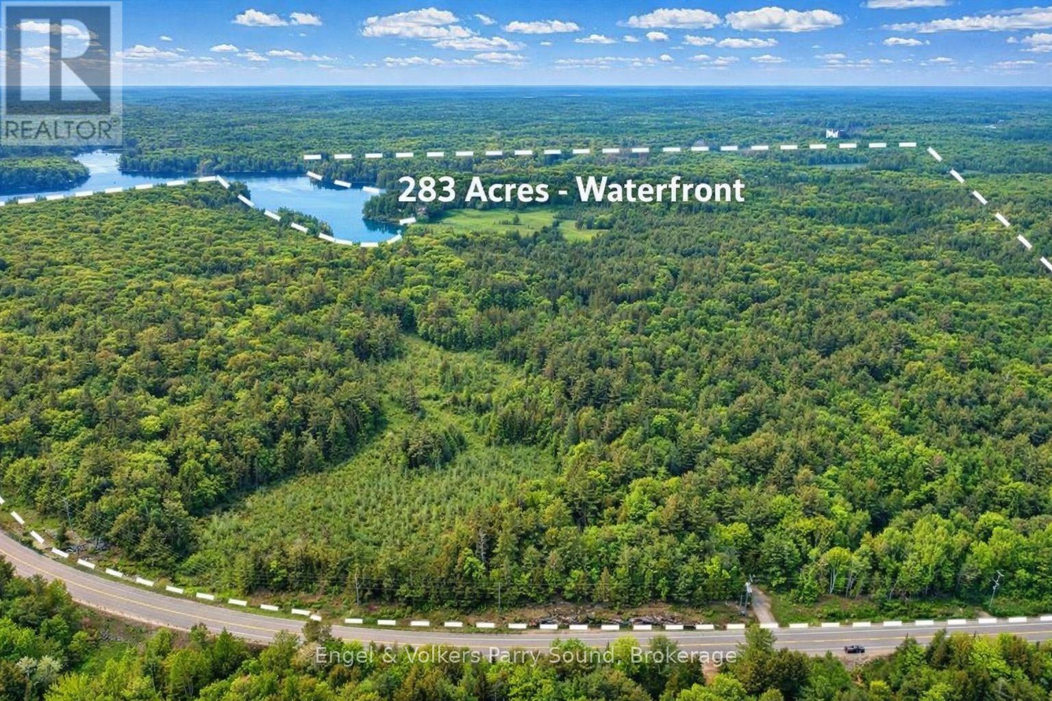
Not seeing the right one?
What is listed today is only part of what sells on a lake in a year. I can tell you what has come up before and what I expect next.
Ask me about Harris Lake
Some properties change hands privately and never reach the public listings. Tell me what you're looking for and I'll let you know what I hear.
This listing content provided by REALTOR.ca has been licensed by REALTOR® members of The Canadian Real Estate Association.
The trademarks REALTOR®, REALTORS®, and the REALTOR® logo are controlled by The Canadian Real Estate Association (CREA) and identify real estate professionals who are members of CREA. The trademarks MLS®, Multiple Listing Service® and the associated logos are owned by CREA and identify the quality of services provided by real estate professionals who are members of CREA.
Information is deemed reliable but not guaranteed. Listings are updated hourly and may have changed since.
Questions about Harris Lake
The one in the Municipality of McDougall, in the geographic township of Ferguson, north of Parry Sound. A different Harris Lake sits on the South Magnetawan River north of Pointe au Baril, and listings for the two are easy to mix up.
It covers 157 hectares, with a maximum depth of 8 metres and an average depth of 3 metres. The shoreline runs 17.9 kilometres, with another 3.2 kilometres around the islands.
Not that I can point you to. The province's fact sheet lists access to the lake as private, and Harris Lake is not on the Municipality of McDougall's list of boat launches and water access points.
Yes. The province's fact sheet lists the level as regulated by a dam owned by Parry Sound Power Generation, with flows and levels governed by the Seguin River water management plan.
The province lists northern pike, largemouth bass, smallmouth bass and black crappie as the main species, along with yellow perch, pumpkinseed and brown bullhead. It is not designated a lake trout lake and is not currently stocked.
Around Harris Lake
Lakes nearby
Nearby towns